Fawn River in Indiana
| Trip
Reports Check out a nice trip report! |
Maps to Fawn River Public Access Points |
 |
|

|
The verbiage below was supplied by Indiana DNR's Canoe Guide. The information was last updated at least 16 years ago. Put-in points have disappeared and new ones have formed. It is very important that you submit any trip reports that you have and include what the put-in and take out points look like. With your help we can build a new and improved Indiana Canoe Guide. We will revise the information below as new information presents itself. |
|
If you have a favorite river, chances are that you know it best. You can adopt a river for this site, then write about it and describe the put-in points. You will get full credit and you will be doing ALL Hoosiers a big favor. |
The Fawn River, located in the northeastern part of Indiana, is generally considered to be one of Indiana's most adventurous rivers. The 44-mile river corridor is twisting and narrow with considerable marsh area along the banks. Unfortunately the river is also crossed by a number of major roads which may detract from the wild character of the river corridor.
The Fawn River rises from a lake in the northwest corner of Steuben County and is supplied by 40 other morainal lakes adjacent to its banks and also by many small tributaries. The many lakes owe their existence to the last advance of the glaciers. In the early days, the Fawn River's water turned mill wheels at settlements in Nevada Mills, Fawn River, Greenfield and Orland.
Nevada Mills to Greenfield Mills
The 10-mile section of the Fawn River between Nevada Mills and Greenfield Mills is a scenic 6-hour float. The river corridor is lined with willow and elm trees and the marshland offers a variety of vegetation growth.
The river has good fishing for smallmouth and largemouth bass and pike, with the most popular site being the mill pond at Greenfield Mills. Camping is available at Pigeon River State Fish and Wildlife Area located 1/2 mile east of Mongo. Camping is also available at Chain O'Lakes State Park four miles south of Albion on State Road 9.
The access site is adjacent to a small bridge on County Road 600 W on the northwest corner where the bank is slightly sloped for easy put-in. Limited parking along the shoulder of the road (600 W) is available on the north side of the bridge. Take out and portage to the left below the large willow trees along the channel at the Fawn River Hatchery at Orland. High water may also necessitate portaging one county road bridge. Other portages may be necessary because of log jams in the stream.
Note - website user Neil VanFleet noted on 4-18-2010: Mention of the portage at the Orland Fish Hatchery Should mention the addition of the Orland City Park. It is built on the site of former fish ponds of the Hatchery that is now only on the West side of the road. This park is large with good parking, water, and restrooms.
Mention should be given to putting in at the newly rebuilt Nevada Mills dam. Adequate public land is available for put in over erosion rocks. However, parking is still limited to shoulder.
The take-out is at the northwest corner of the Greenfield Mills Pond because the water is shallow and the banks are easily accessible. The old mill still produces electrical power and grinds grain for flour. The car shuttle from the put-in begins north on County Road 600 W and moves west on State Road 120 through Orland. Turn right at LaGrange County Road 1100 E and head north about 1.5 miles until the road forks. Take the left fork 1 2 mile to the first road on the right. Winding around the pond, the take-out is on the right.
Greenfield Mills to Fawn River Mill Pond
The 14-mile section between Greenfield Mills and Fawn River Mill Pond is an 8-hour float along densely wooded banks. The banks are lined with elm, white oak, hickory and willow trees. Sections of the river have marsh vegetation.
Fishing is good for catfish, smallmouth bass and pike. There is also fishing in nearby lakes that are not privately owned. Camping facilities are located in Pigeon River State Fish and Wildlife Area and at Pokagon State Park south of the Indiana Toll Road 2 miles on I-69. Doctor assistance may be obtained in Howe, Indiana and hospital care is available in Sturgis, Michigan.
Use the site in Greenfield Mills to put in. The canoe must be carried 100 feet from the car and you should exercise caution because of the steep banks.
There are no dams on this stretch, but two low bridges may require portages in high water. Other portages may be needed because of possible log jams. The car shuttle from the mill to the take-out returns to State Road 120. Take Highway 120 west to County Road 475E and continue north to the town of Fawn River. Proceed through Fawn River 1/2 mile to the bridge at the mill pond. The take-out site is at the southeast corner of the bridge. The bank is short with a slight slope and there is ample parking along the road near the bridge.
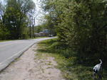
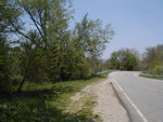
Here are some pictures of the Fawn River Mill Pond Public Access Point:
ATTENTION: As of September 2011 they are in the process of dredging the millpond and this will affect travel in several ways. Access is now restricted because of these activities and under direction also of Federal Agencies such as Homeland Security. The portage access is also affected and is being redirected for up to 2 years.
Fawn River Mill Pond to Star Mill
The nine-mile section of the Fawn River between Fawn River Mill Pond and Star Mill is at least a five-hour float. The river flows slowly through woodland and marsh areas as it meanders to its destination. Elms, oak, ash and hickory trees dominate the wooded sections and a wide variety of wildlife inhabit the marsh areas. Log jams are a possibility.
The put-in is located on the southeast side of the Michigan County Road bridge which is an extension of Indiana State Road 3 north of the town of Fawn River. The bank of the river is 100 feet from the roadside with a gradual slope for easy accessibility.
The car shuttle should travel south on the Michigan County Road and Indiana State Road 3 to Road 600 N. Turn right and proceed to State Road 9 then turn north and go approximately 1 mile. Turn left on County Road 700 N and go about 1/2 mile to the bend around the river. The take-out is on the right side of the road at the curve around the river. A portage around the Star Mill Dam will be required if you intend to go on down stream. Parking is available on the side of the road.
ATTENTION: As of September 2011 they are in the process of dredging the millpond and this will affect travel in several ways. Access is now restricted because of these activities and under direction also of Federal Agencies such as Homeland Security. The portage access is also affected and is being redirected for up to 2 years.
Star Mill to the 600 W Bridge
The 11-mile float between Star Mill and County Road 600 W bridge is a rough section and you should expect to encounter frequent log jams. The six-hour trip is between banks lined with forest and agricultural areas.
The put-in site is directly beneath the old Star Mill house off County Road 700 N in LaGrange County. The take-out is at the southwest corner of the 600 W bridge in LaGrange County where you have room to park on the road and only a moderate slope to the water's edge. The car shuttle should take road 700 N and go west to County Road 600 W then turn north and proceed 3/4 mile to the bridge.
ATTENTION: As of September 2011 they are in the process of dredging the millpond and this will affect travel in several ways. Access is now restricted because of these activities and under direction also of Federal Agencies such as Homeland Security. The portage access is also affected and is being redirected for up to 2 years.
