Maps to Big Pine Creek

Below you see a clickable map showing the various Public Access Points (P.A.P.s)  The exact location of the public access points were painstakingly recreated by cross-referencing the verbal description to the P.A.P. with the less than ideal map provided by Indiana D.N.R.  The D.N.R. map is also included below.  It is a vital map because it shows you the locations of any dams that may exist along the river.

Remember that these rivers are different than the commercially run rivers.  There isn't a crew to scout and remove any snags that may exist.  DO NOT TAKE CHANCES!  Be sure to scout any potential danger areas.

Please report any errors in the maps by clicking here.

Click here to view the official river trail map provided by Indiana D.N.R.

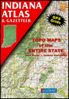
The maps on this site are best when used with Delorme's Indiana Gazateer Book.

You will help fund this site if you purchase one by clicking the link to the right.

I have made it easy for you by creating a direct link to this essential book on Barnes and Noble's site.


Clickable Image Map


© Copyright 2000 The Technological Edge, Inc.