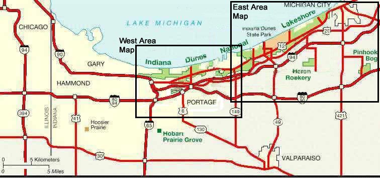
Clickable
Map of Indiana Dunes National Lakeshore
Once you click on the specific square you will be taken to a page that is designed
to be printed in Landscape mode
Other Available
Maps of Indiana Dunes National Lakeshore:
(best printed in Landscape
mode)
a huge map of the area (320K) [It is STRONGLY recommended that you use the pdf versions below]
pdf version of a nice detailed area map (225K) [this map is very useful, though you must have Adobe Acrobat Reader]
pdf version of the West Area Map (312K) [better detail of west area, though you must have Adobe Acrobat Reader]
pdf version of the East Area Map (290K) [better detail of the east area, though you must have Adobe Acrobat Reader]
pdf version of the overview map (28K) [less detail than above, and you must have Adobe Acrobat Reader]
If you don't have
Adobe Acrobat Reader get it by clicking to the right! ![]()
Back to Indiana Dunes National Lakeshore info page
|
||||||||||||||||||||||||||||||||||
 |
||||||||||||||||||||||||||||||||||