| Trip
Reports Click here for some trip reports with pictures. |
Topographic
Map of Trail (284K) |
Detailed
Map to Trailheads |
Outfitters |
The trail crosses several steep ridges as it heads south from the Leota Trailhead through the Clark State Forest backcountry area. It then drops into the lush North Branch Valley, one of the most scenic areas along the trail (abundant ferns, wildflowers and very large trees), before winding its way up a very steep, north-facing slope. The trail then traverses rolling to rugged terrain again, past a few wildlife ponds, to the New Chapel Trailhead. The total length of this segment is approximately 9 miles.
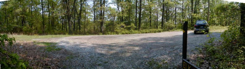
The Leota Trailhead
has a nice little parking lot in the woods...
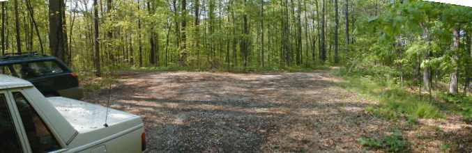
The New Chapel Trailhead
is also nice and quaint...
The Leota Trailhead is located east of the county road which goes north from Leota Road, about 2 miles west of Leota. The trailhead is near a small power transmission line.
To drive from the Leota
Trailhead to the New Chapel Trailhead, turn left (south) from the Leota Trailhead
entrance road (gravel) onto a gravel county road and proceed 0.1 mile to Leota
Road. Turn right (south) and continue for 1.7 miles to the first intersection
. Turn left (south) onto New Salem Road and proceed for 3.4 miles to the intersection
with S.R. 160. Turn left (east) onto SR 160 and continue for 1.8 miles to the
unmarked county road to the left (north)-watch for "KT" post. Turn
left (north) on this road and continue of 0.4 mile to the New Chapel Trailhead
entrance road to the right (east).
|
||||||||||||||||||||||||||||||||||
 |
||||||||||||||||||||||||||||||||||